• Category Archives: News

    • 483

    Digitization News

    Category : News

    electrial

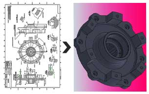
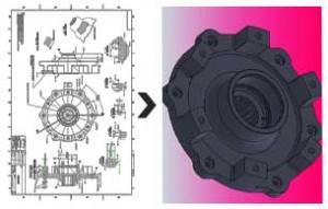
    The process of representing an analogue signal or an image by a discrete set of its points is known as Digitizing. This data after conversion is in the binary format, which is directly readable by computer. The data to be converted can be a text, an image, audio or a video. The analogue signals are variable whereas the digital format is the discrete one. These discrete units are called as bits. These bits (8) organized in groups are known as byte. The digital signals are mainly represented in the form of sequence of integers. These integers can be converted back to analogue signal that are approximately similar to the original analogue signals. Digitizing is done by reading an analogue signal ‘A’, and at regular time intervals, representing the value of ‘A’ at that point by an integer. Types of Digitizing: Manual Digitizing: It is done using digitizing tablet. The operator manually traces all the lines from his hardcopy map and creates identical digital map on the computer. It is very time consuming and level of accuracy is also not very good. Heads-up Digitizing: It is similar to manual digitizing in the way that lines have to be drawn manually but directly on the computer screen. So in this level of accuracy increases and time taken decreases. Interactive tracing method: It is improvement over Heads-up digitizing in terms of speed and accuracy. Automatic Digitizing: It is automated raster to vector conversion using image processing and pattern recognition techniques. In this technique computer traces all the lines, which results in high speed and accuracy along with improved quality of images.

    • 152

    Aerospace Design News

    Category : News

    Boeing re-examining 787 delivery schedule

    mechanical

    Boeing is again reviewing its 787 delivery schedule ahead of a “mountain” of rework required to prepare each aircraft for delivery, likely prompting a new delay to customers once the assessment is completed in the coming weeks. The airframer continues to target February 2011 for first delivery to All Nippon Airways (ANA), reports Flightglobal affiliate FlightBlogger, though the amount of post-certification rework required on the incomplete airframes could cause delays of weeks to even months, depending on the customer.

    Boeing currently has 22 production aircraft as various stages of assembly for 787 launch customer ANA, Japan Airlines, LAN, Royal Air Maroc and Air India.

    The report states that issues such as “a flight deck window popping sound discovered during flight test, addressing cabin condensation issues, reworking passenger doors, resolving workmanship issues on the aircraft’s horizontal stabiliser and incorporating changes to the Trent 1000 engine, are among the issues that add up to slide the deliveries to the 787’s earliest customers well into 2011 or potentially even 2012.”


    • 9

    CAD Design News

    Category : News

    Generative Design Is Changing the Face of Architecture

    2d-3d

    New technology allows humans to harness computational powers for practical ends and to generate building design options that couldn’t otherwise exist. Generative design — allows humans to control intellectual forces many times more powerful than human minds to design and construct buildings that could not otherwise exist. It is not the first time, of course, that humans have harnessed vast computational powers for practical ends, but something about walking around inside the results brings home the magnitude of what is happening.

    Humans are fond of impressive buildings. The 2008 Olympics, for example, probably will be remembered as much for two spectacular buildings — the Beijing National Stadium and the Beijing National Aquatics Centre — as for the many world records that were set in them. Better known as the Bird’s Nest and the Water Cube, respectively, the buildings’ design, engineering, and construction depended heavily on generative design. By seizing the world stage so dramatically, the two buildings raised the profile of generative design (also called computational design or parametric design) and, to some extent, architecture may never go back.

    GenerativeComponents is associative and parametric modeling software that can be used by architects and engineers to automate design processes and accelerate design iterations. It gives designers and engineers new ways to explore alternative building forms without manually building a detailed design model for each scenario. It also increases efficiency in managing conventional design and documentation.


    • 7

    Photogrammetry News

    Category : News

    3D City Modeling

    3D city modeling is becoming an increasingly important area of research and development with a wide array of applications including urban visualization, planning and navigation, infrastructure design and development, community awareness, defense and homeland security, emergency response, and resource development. Important research problems arise from data capture and processing, 3D model construction, automatic feature extraction, interactive navigation, data streaming, compression, and many more.

    3D models of cities are a critical area for CAD/GIS/games integration, and offer significant benefits to urban planners and developers, especially related to issues such as pollution, heating, lighting, noise abatement and crime. Future city design will need to take a more holistic approach to these issues rather than simply focusing on isolated buildings or even neighborhoods. This demands broader and more flexible sharing of information across multiple jurisdictions and disciplines. Recently, 3D city models have been incorporated as “eye candy” in both Microsoft Bing and Google Earth/Maps, and one can anticipate greater use of these models than they are already now, such as on mobile devices.


    • 11

    GIS News

    Category : News

    GIS SERVES MANY BRANCHES OF SCIENCE AND INDUSTRY

    mechanical

    Any time a map is required, chances are good that a geographic information system (GIS) was involved. Used primarily at one time by mapmakers, scientists and researchers, advances in GIS technology have allowed it to be used in virtually every area of our lives. A GIS model takes information that users deem necessary for their project purposes and compiles it, using a set of parameters the users have chosen. The GIS takes the information it receives, analyzes it and breaks it down into smaller bits according to location. Those smaller bits can be assembled into a larger whole to predict such things as the spread of an epidemic.

    Data can be arranged by phone number, zip code and other means established by the user. GIS unites databases with cartography, then analyses the information, which can be displayed in map format of smaller locations or as a worldview. GIS can be used for a variety of mapping requirements in different disciplines. Developer can utilize the information for feasibility studies, the impact a housing project will have on a wetlands area, or even where to place a fire hydrant in a city development project. Some uses, such as fire hydrant placement, may seem simple, but not to the people who may have to rely on that fire hydrant in the future.

    Surveyors have been combining information from global positioning satellites (GPS) with GIS for more accurate land divisions. Many online mapping systems, such as Google Maps, employ a type of GIS. GIS can help scientists ascertain the extent of global warming and the areas that will be most affected, combining them with satellite or aerial data. They can then extrapolate the results of an increase in global temperatures, excessive rainfall or the lack of it, as well as drought conditions and rising ocean levels.

    Archaeologists make use of GIS models to learn w hat conditions were millions of years ago, and help determine where landmasses and oceans were located by building a map of the different layers of earth. Using that information can lead them to promising expedition areas.